Special Meeting Of Council: Boundary Expansion, Official Plan
By John Swartz
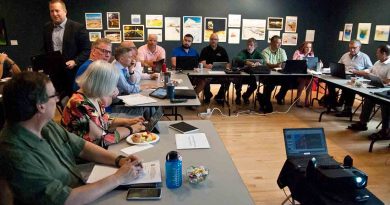
Orillia council has a special meeting Tuesday February 4 starting at noon. The purpose is to select a housing density goal to meet provincial requirements for population growth (and containment), which in turn will define how much land will be needed to meet that goal. This relates to the boundary expansion plan the City will work with for how much more land will need to be annexed from neighbouring townships to satisfy the population goal.
A second report is on the agenda from staff as a review of work done on a review of the Official Plan and staff are asking at the same time for council to endorse 31 policy directions to further that work.
Housing Goals
The city hired Hemson Consulting Ltd. to do a land needs assessment study, which was completed in April 2023.
The province required municipalities to plan for target growth 20 years out. As a planning exercise, it’s not just places to live, but places a greater population will work and play at, schools, along with servicing (mostly roads and pipes) growth.
The intent of provincial policy is to target growth in existing centers of population by intensifying living spaces (more people living on less land) and contain urban sprawl. Orillia’s target population is 49,000 people with 26,000 working by 2051.
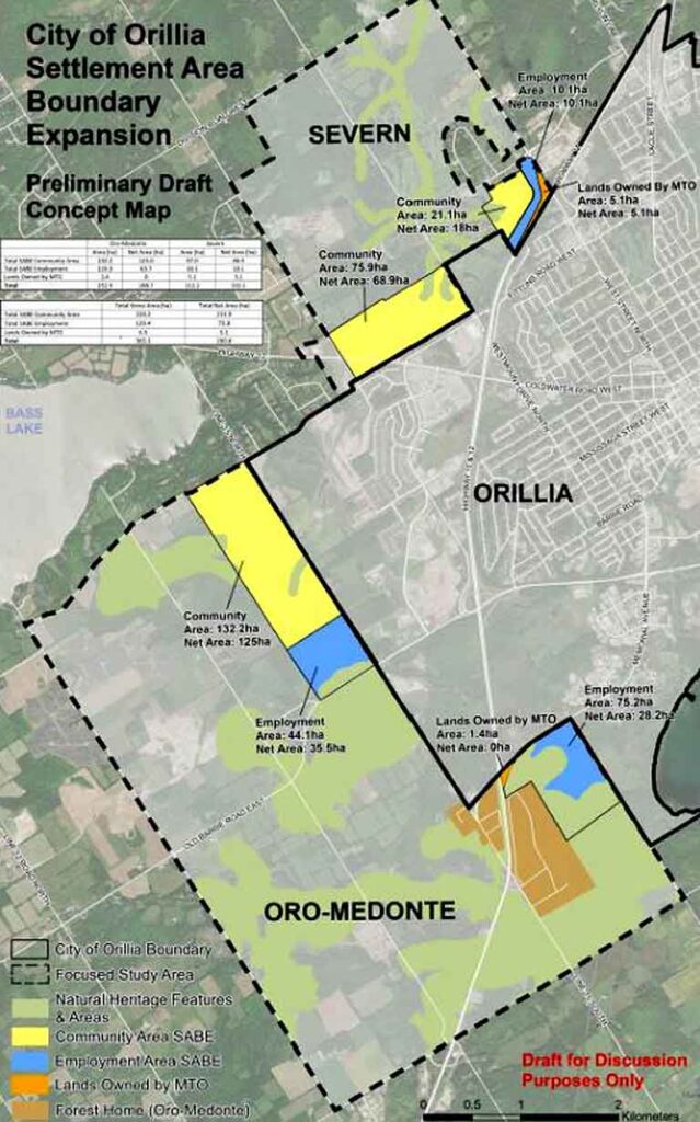
The study revealed there is only enough room within the current city boundaries to accommodate growth to 2030, hence a need for more land. The original determination proposed large areas of Severn, Oro-Medonte and Ramara townships to be brought into the City. Those areas included land that couldn’t be built on at all or at reasonable cost. For example, Ramara township has limestone bedrock with mere inches of soil on top, Severn has the beginnings of the Canadian Shield and Oro-Medonte’s bedrock is much deeper (which is why there are more farms).
A more detailed and exacting study was done by WSP (Williams Sale Partnership), which ruled out Ramara as a direction to go, and evaluated conditions of the land for building upon in the other two townships. This resulted in trimming down the amount of land needed from 14.5 thousand hectares to 2,649 hectares.
That was according to development as it has been with the Official Plan in play. Because of the work of WSP, the amount of land needed under current development targets shrunk to 365 hectares, of which 190 is developable. That is to accommodate 33 housing units per hectare.
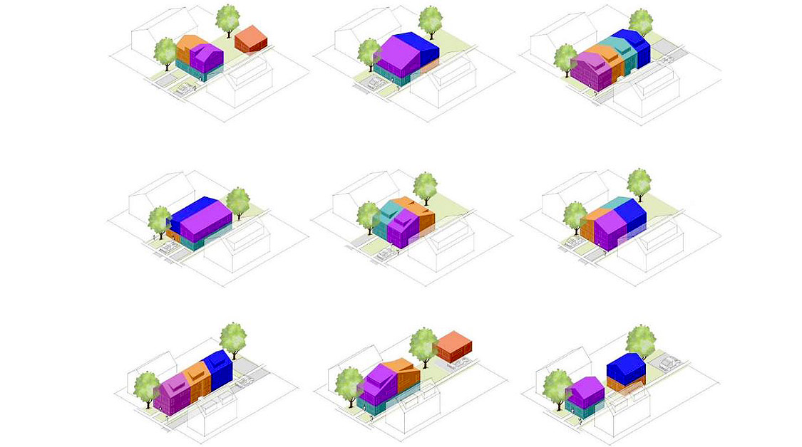
The study proposed council choose from 6 plans ranging from 60 units to 33 per hectare. Each increment above 33 reduces the amount of land needed.
Staff are recommending council pick 47 units, which will reduce the amount of developable land needed to 155 hectares. The types of housing this would result in are stacked townhouses, back-to-back townhouses, multiple dwellings, and apartment buildings and building heights would be a minimum of 3 stories and the maximum would be increased to 12 stories in specific areas (typically along collector roads). The new development on the former Mount Slaven Public School land fits in this criteria.
Staff have alternative motions for council of 33, 40, 54 and 60 units per hectare, but are not recommending those.
Of course council cannot make housing standards for land beyond City Limits, but adopting a goal now would encourage development inside the City immediately and reduce the effect of running out of room again at some date before 2051. It will take several years for any boundary expansion to be made effective.
Official Plan
The update staff have on their work stalls at the point where council has to decide some key policies, 31 of them.
The major ones are:
- Deciding the birds-eye look of the City (i.e. this area is housing (predominately), along these roads will be apartment buildings this one warehouses, this area will be (is) parks, etc.)
- Choosing the areas for higher density, taller buildings.
- Deciding the size of the Transit Hub growth area (one would naturally want the most people living in proximity to the new transit hub).
- Deciding on a maximum building height(people who have participated in the process so far overwhelmingly say 8 stories, the land needs assessment noted above is for 12 stories – in higher density designated areas.
- Setting employment areas.
- Deciding to allow multi residential housing per lot (townhouses, duplex, triplex, quadraplex) development in older neighborhoods.
- Adopting a transit friendly approach to major developments (i.e. buses can get into and out of, or through more efficiently than has been the practice).
- Climate change considerations related to public transit, tree planting in new developments and other objectives.
- Allowing staff to set limits to development near wetlands, woodlands, and fish habitats)
- Mapping flood plains and setting standards for development in or near them.
- Combine the Stable Neighbourhood and Neighbourhood Greenfield designations into a Neighbourhoods designation, with a goal of allowing small business to locate (restaurants, cafes) shops in a medium density housing area.
Other policy directions include:
• Create a new “Mixed Use” designation
• Permit Apartments, Multiple Dwellings and Stacked Townhouses on all Collector and Arterial Roads up to 4 storeys in height as-of-right
• Establish clear built form policies to guide compatibility
• Prioritize surplus publicly owned land for affordable housing
• Rental Replacement Policy
• Expand the range of permitted uses within the Downtown Area
• Implement new Parks, Recreation and Culture Master Plan
• Support placemaking and Indigenous community-building
• Provide flexibility for childcare spaces
• Support creative industries and public art
• Support the achievement of a network of safe, complete streets
• Improve Active Transportation opportunities
• Future-proof for transit
• Plan for a Changing Climate
• Strengthen the local food supply chain
• Improve and update transportation and mobility policies to support climate change mitigation
• Protect and enhance the robust City-wide tree canopy
• Encourage sustainable building practices and design
• Plan for climate resilient infrastructure
The City has held several workshops, public meetings and on line surveys to get to this point. More information and previous reports regarding boundary expansion and the official plan are online.
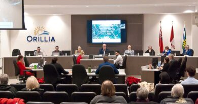
Council meetings are open to the public or can be watched on the City’s Youtube channel.
(Images Supplied) Main: Proposal for types of housing allowed per lot.